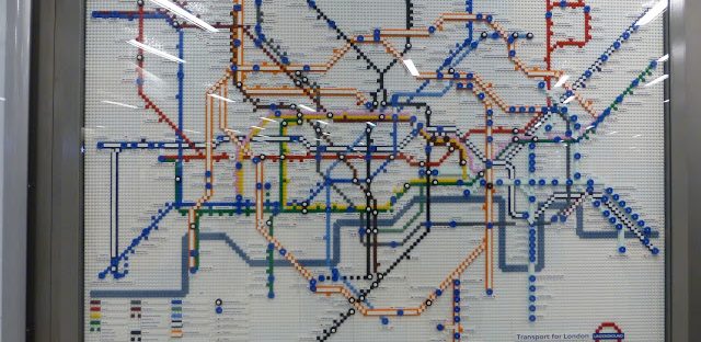
We are celebrating 150 years of the London underground this year and all kinds of inventive approaches have been used to make this a fun year on the tube. My favourite is the wonderful Lego tube maps dotted around London!
On 9th January 1863 the very first underground railway journey was made from Paddington Station where you can see the commemorative plaques and photos. The underground train travelled just 3 and a half miles under London’s streets to Farringdon station and history was made.


A picture from Paddington station
There are 5 specially created maps made of Lego bricks which show the tube system and how it has developed over the years since 1927 (although there were maps before then) and the proposed future size and scale of the tube in 2020. I’ve been hunting them down in the 5 ticket halls and here they are from South Kensington, Picadilly Circus, Green Park, Stratford and King’s Cross.
The oldest map is from 1927 and looks very different from version we are used us as back then they superimposed the tube lines onto a map of London show this is really how it looks!
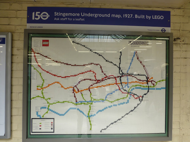
South Kensington station’s map
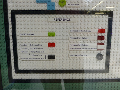
The key to this strange looking map
Chronologically we next have a map from 1933 and this is Harry Beck’s original design which is the basis for our current versions so islooking more familiar. He expanded the central area to make it clearer and simplified the look by distorting the actual distances between stations and the shape of the lines. A radical idea but it has stood the test of time. While checking out this map I had to stop several tourists from using it to plan their journey, it was hard to explain why there was a map from 1933 on the wall!
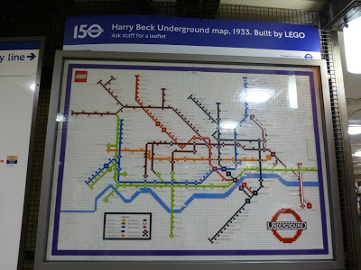
Picadilly CIrcus station
We jump to 1968 to see various changes such as an extended Central line and a change of colour to brighter red, a longer Northern line and by the look of it, much more Circle line.
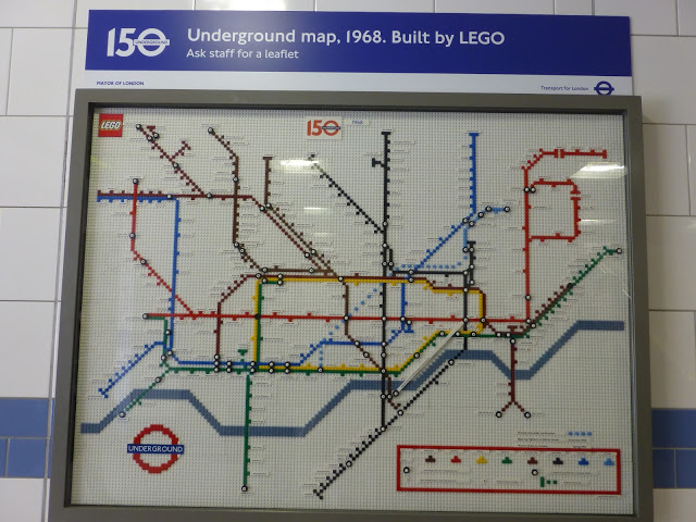
Green Park station
In 2013 we see our familiar map which has grown from 1968 with the addition of the orange showing the overground lines circling London, the arrival of the Jubilee line and of course the Docklands Light Railway.

Stratford station
In a peek into the future we can see 2020’s network showing the major development of Crossrail cutting through the centre of London, the Croxley link in the north west and the Northern line extension at Battersea. It’s an ever changing system as it has to adapt to the different requirements of commuting of the future, travellers’ needs and the challenge of carrying over 1 billion passengers a year!
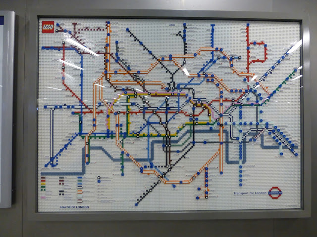
King’s Cross station
The vital statistics of these maps are thanks to the London Underground website:
- Each map is made up of over 1000 LEGO bricks
- The LEGO Tube maps measure 140cm x 100cm
- Each map took four days to build
- Created by Duncan Titmarsh, the UK’s only Certified LEGO Professional – there are only 13 in the world!
Hope you enjoyed a some time travel via the London tube
Bye for now,
Sue
itsyourlondon.co.uk
@itsyourlondon
